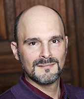
Álvaro Santana-Acuña
Álvaro Santana-Acuña is Assistant Professor of Sociology at Whitman College (United States). He has held teaching positions at Harvard University and the University of Chicago, and research fellowships at the American Academy of Arts and Sciences, Harvard University, Stanford University, University of Chicago (Fulbright Program), University of Texas at Austin, Institut d’Études Politiques-Sciences Po, and École des Hautes Études en Sciences Sociales. He is the winner of research awards from the American Sociological Association and the author of Ascent to Glory (Columbia University Press, 2020). His research has been featured in The New York Times, Time, Atlantic, and El País, among other media.
Research Interests
Nation-state formation; eighteenth-century French history; social theory; science, knowledge, and technology in relation to state-formation; cultural sociology; material culture (especially, art classics).
Big Spatial Data, Cadastral Mapping, and the Invention of Modern France
The detailed land survey of a nation’s territory, known as the cadastre, is one of France’s most remarkable scientific and political achievements and one of its most influential contributions to the making of the modern world. First under the reign of Louis XV, next during the French Revolution and Napoleon’s invasion of several European countries, and finally due to France’s role in colonialism and global politics, the French cadastre became the model for other national cadastres in Europe, America, and Asia. Yet, unlike constitutional texts, population censuses, and works of public infrastructure, the national cadastre is among the least studied of French instruments of governance. In particular its contribution to nation-state formation is not fully understood. At the Paris Institute for Advanced Study, I am working on a book manuscript, currently entitled The Nation of Triangles: Cadastral Mapping Invents Modern France, that seeks to fill this gap in the literature and reveal how an unprecedented effort at gathering and standardizing big data about the country’s land made it possible to produce a new image of the state as a unified, homogeneous, and contiguous political territory. That is, the kind of standardized territory now regarded as a foundation of nation-states.
|
Alvaro Santana-Acuna, Paris IAS Fellow, presents his research project at the weekly internal seminar |
|
|
|
|


